FIRM: Flood Resilience Simulation Model on DAFNI
Introduction
The FIRM Flood Infrastructure Resilience Model simulates flooding and the human response to flood events. That human behaviour element, and the interactions between people and flooding, is the key distinguishing feature of FIRM.
FIRM can be used to explore flood events of different magnitude and test the effect of choices people make in response to extreme weather events, in order to model how people are likely to be exposed to dangerous depths and speeds of water.
FIRM will help flood resilience forums, councils and policymakers implement improved before-the-flood measures such as better public education and warning systems, improved during-event people and traffic flows, and improved infrastructure resilience evacuation sites.
Who’s involved?
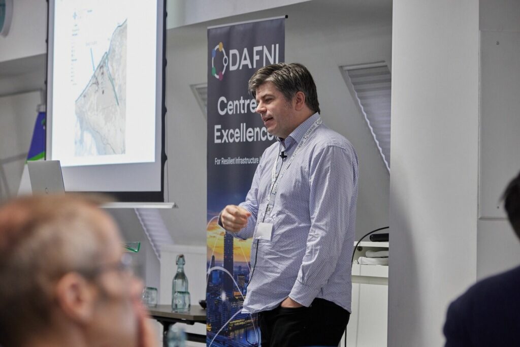
The FIRM project is led by Richard Dawson, Professor of Earth Systems Engineering in the School of Engineering at Newcastle University. Richard’s research focuses on infrastructure resilience to extreme weather and climate change. He is a member of the UK’s Committee on Climate Change, Lead Author of the Cities, Settlements and Infrastructure Chapter of the Intergovernmental Panel on Climate Change 6th Assessment Report, and a Fellow of the Royal Academy of Engineering and of the Institution of Civil Engineers.
When did the project start and finish?
The project ran from 1st of October 2023 to November 2024.
Key challenges that FIRM aims to solve
Individuals, councils, first responders and others involved in sudden flood events can behave very differently, and these varied responses can have a dramatic impact on the safety outcomes for people and infrastructure.
There are really only a modest number of big picture options for individuals themselves during flood events – to evacuate, to stay in their property and add resilience measures, to refuse to do anything, or to go out and ‘investigate’ or ‘mess around’ in the flood waters. In reality, around a third of people take each of the major options available to them, with the latter option only taken up by a few outliers.
The model includes risk to people and property. It helps to inform evacuation planning and where safe areas should be set up, as well as choke points and congestion points during evacuations
What was the key aim of the project?
The Flood Infrastructure Resilience Model is a coupled agent-based and hydrodynamic flood model built on a geospatial data architecture. It is designed to be used to explore the impact of the flood infrastructure failure on flood resilience, and to test strategies to mitigate the impact of these shocks.
For example, one of the major challenges FIRM examined is how to identify suitable evacuation locations – with the aim of minimising points of congestion in pedestrian and road traffic spaces, and improving human safety. More appropriate evacuation sites can reduce the impacts of flooding, and risk to people dying or drowning or being injured during floods.
FIRM integrates remotely sensed information on topography, buildings and road networks with empirical survey data to fit characteristics of specific communities. Simulation of individuals has been coupled with a hydrodynamic model to assess their response and their resilience in the event of flooding.
FIRM allows resilience planners to identify likely impacts of flooding on congestion areas to help them improve and identify key evacuation routes, and alternative evacuation routes should flood defences fail. This will help them plan and implement mitigation measures in advance rather than ‘on-the-fly’ during crisis situations. For example, a one-way street system in certain areas may lead to improved traffic flow during peak evacuation times.
What did DAFNI allow you to do that you couldn’t otherwise have achieved?
The research software engineering expertise that DAFNI funded was key for FIRM – to help move the model from code with assumptions and inconsistent data structures to create a model that can now readily be applied to any part of the UK, and even outside the UK – with a bit of additional processing.
The model that’s now on DAFNI represents a step change in terms of making it easier to use and will ensure it is picked up and used more operationally to test the resilience of communities to floods.
DAFNI funded research software engineers at Newcastle University to re-code FIRM into Java for greater interoperability and integrated FIRM onto DAFNI to make it more accessible to the community.
The outputs from FIRM can be used as additional evidence to support recommendations for mitigation measures and can replace some of the work such as surveys or live exercises which are expensive and time-consuming.
FIRM being part of the DAFNI ecosystem has allowed Richard and team to attend the DAFNI Conferences to present and raise awareness of FIRM, and to have useful conversations with government, industry and academic researchers. Richard has also found being part of DAFNI useful in terms of shared learning around the DAFNI community and helping develop the model.
What outputs from the project have you put onto the DAFNI platform?
The FIRM model is now available on the DAFNI platform.
How do you anticipate other researchers, policymakers and stakeholders using this work?
DAFNI makes the FIRM model more accessible and widely applicable.
Conversations are ongoing with various organisations and researchers around the world in working in infrastructure and urban resilience as well as interest from organisations in areas such as transport about how they may integrate FIRM into their emergency planning.
What would you identify as the main impact of this work?
The FIRM model allows policymakers, councils, first responders and planners to explore and test different strategies and problems and highlight where issues such as overcrowding or poor access or ingress routes emerge. This leads to better planning and mitigations, for reduced risk to people and infrastructure.
Flood events and evacuations in the UK are becoming more frequent and will be used by planners, researchers and infrastructure organisations here.
The FIRM team has also been liaising with researchers elsewhere around the world, in Indonesia, for example, where high intensity rapid onset downpours frequently cause danger to life and infrastructure, and the model can help with the challenges caused by these massive floods.
How could this work benefit society as a whole?
Actions taken before, during and after the shock of flood infrastructure failure can lead to radically different outcomes. Poor warnings, slow evacuation, or failure to erect temporary flood defence infrastructure all reduce resilience, increase damages and threaten lives.
The FIRM modelling has been applied to a coastal town in North Wales which is prone to flood events and has the additional challenge of many bungalows and caravans. The topography of the land and the topology of evacuation routes means people can get trapped by floodwater, and identifying areas most at risk was an important part of the project.
The model has also been applied in an informal settlement in Nairobi, Kenya. In Nairobi the modelling identified points of congestion river flooding, and showed that one designated evacuation site actually increased risk during flooding, as people had to go through flooded areas to reach it. The underlying mapping that feeds into FIRM can vary according to country and data available – when used in Nairobi, OpenStreet Map was used, for example.
What are the next steps?
Richard is currently carrying out some sensitivity testing and looking at a wide range of conditions to see where hotspots occur. Further funding permitting, he would like to use the USARIS model (also on DAFNI) which aims to tackle one of the challenges in using model outputs for policy decisions – i.e. that models are conditional on many uncertain assumptions. There can be a lot of uncertainty around system drivers and properties, data gaps and errors, and simplifying assumptions.
Integrating USARIS with FIRM will help cement FIRM’s credentials with policymakers and further build trust in the model for other researchers, by quantifying the range of variability in the model outputs and the relative contribution of different uncertain inputs to that output uncertainty.
Richard also has a PhD student picking up on the theme of evacuation modelling who will use FIRM as a starting point.
In conclusion, Richard says, “It’s exciting to see how much interest there is in FIRM and I’m delighted to work with people interested in using the model and working together to build an eco-system of collaborators interested in using simulation tools to improve society’s resilience to flooding.”